
Photos
Sconset
Siasconset village was first settled three centuries ago as a whaling outpost, centered about a lookout tower for spotting the giant sea mammals as they swam off ‘Sconset’s shores. Many of ‘Sconset’s cottages date from these early origins, from rough-hewed 17th and 18th century fishermen’s shanties. They have been altered and added on to over the centuries, of course, but in scale and style they remain true to their history.
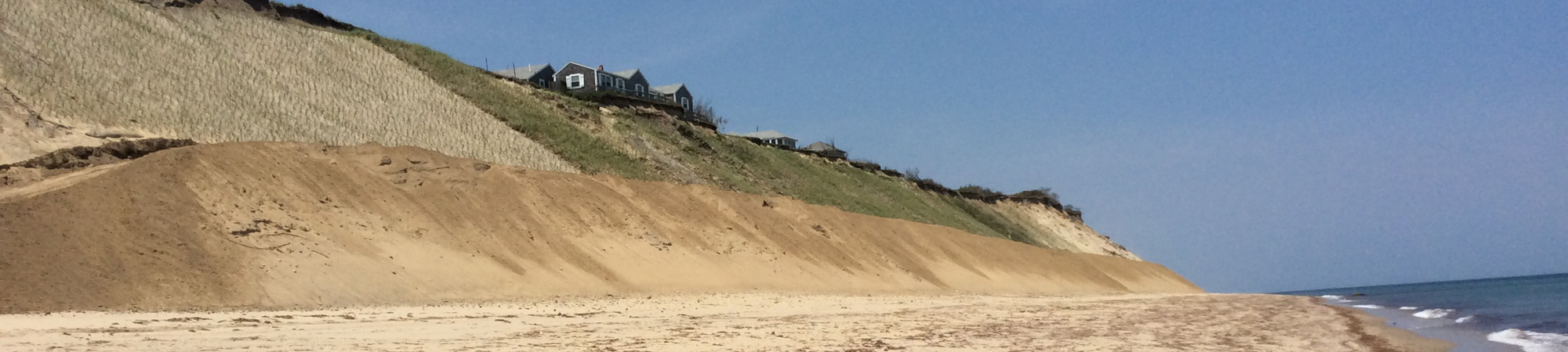
A key and beloved ‘Sconset feature is Sankaty Head Lighthouse. This iconic brick tower, reached by Baxter Road, was constructed in 1950 and rises to a height of almost 70 feet. Over the years, erosion slowly ate away at the bluff in front of the lighthouse, and by the early 1990s all buildings on the grounds were removed except for the tower itself. In 2007, the ’Sconset Trust took ownership of the Historic Sankaty Head Lighthouse property and moved the Lighthouse to safer ground. The homes along Baxter Road, as seen in the aerial photos, are similarly threatened by erosion.
")


Geotube Installation
The first step in constructing the geotube installation is to stake out where the work can take place landward of the high tide line. Next, a sea water reservoir is dug along the beach at the southern end of the project to provide the water to fill the geotubes. A pump submerged in the water hole pumps the water out of the hole and into a pipe that runs along the beach. The water runs through the pipe, into the hopper where it is mixed with sand to create the “slurry” that fills the geotube. The deflated geotextile bag is placed in position and the hose containing the slurry is attached. Geotube material is woven, high strength plastic that allows the water to seep out while keeping the sand in. After the geotube is filled the crew prepares to close the port where the hose carrying the slurry was attached. The port is tied shut and 1/2 bag of concrete is placed in the port and a piece of geotextile fabric is secured over the port. The final step is to cover the entire installation with sand. The sand is brought to the bluff, placed over the side by a conveyor belt and spread over the top of the geotubes.


Geotubes Doing Their Job
During storm events the geotubes are doing their job. The waves are crashing against the toe, exposing parts of the sand-covered geotubes and protecting the toe of the bluff. The erosion protection system is composed of 4 tiers of geotubes. The 1st tier is below grade, the 2nd tier is seen exposed here as designed after storm Jonas and the 3rd tier is partially exposed. The 4th tier remains covered by the sand template. There has been no erosion at the toe of the bluff and no threat to the geotube protection. After a storm event the geotubes are recovered with sand pulled down from the template. The jute bags (far right photo), which have been installed by individual homeowners, just south of the geotubes, break up during major storms and need to be continually replaced.


")
Vegetation and Drainage
SBPF was finally granted permission by the Nantucket Conservation Commission to vegetate the bluff with native grasses. We were only allowed to vegetate the area directly above the geotube installation. From the photos you can see the different stages of plant growth and the stark contrast to areas that have no plantings. The vegetation helps with erosion on the face of the bluff. The small section at the top of the vegetated bluff is left unplanted purposely to allow for the nesting of native birds.
The installation of a catch basin and drainage system to manage the runoff from Baxter Road was an absolutely necessary component of the erosion protection project. Without it, the bluff would continue to experience erosion from the top even though we have successfully protected the toe through several years of winter storms.


