The Challenge
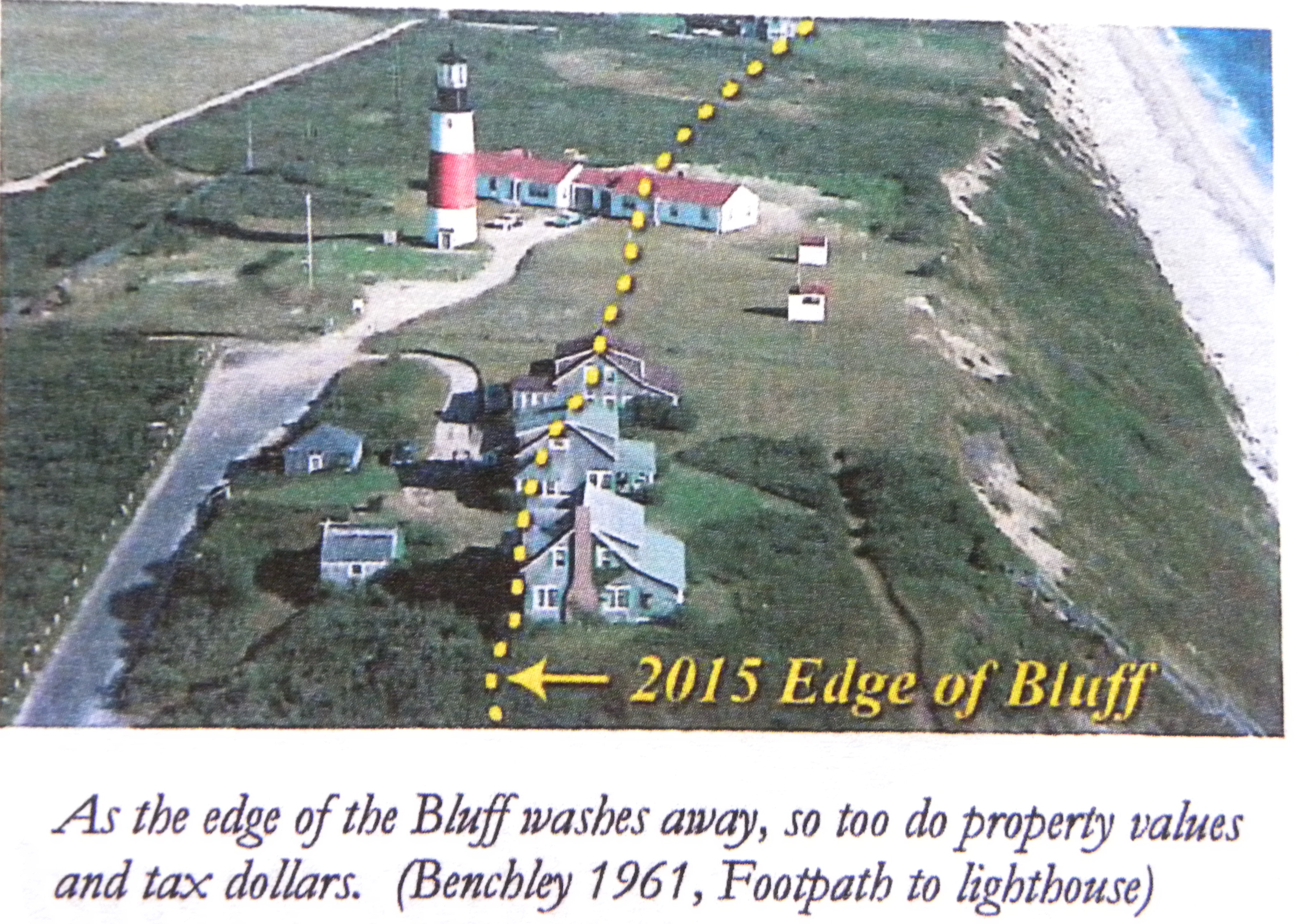
Erosion by the numbers at ‘Sconset Beach & Bluff
Each year, ‘Sconset Beach and Bluff is at risk of further erosion, a situation that need not be a “fact of life.” The installation of a 900-foot pilot geotubes project in 2014 showed that we can protect and preserve the historic ‘Sconset Bluff, Baxter Road, and access to Sankaty Head Lighthouse while maintaining the quality of our beaches.
Unfortunately, another 3,000+ feet (between Sankaty Head Ligthhouse and 59 Baxter Road) are still facing unnecessary erosion each year (albeit to a lesser degree) without expanded protection, because the Town has not approved an expansion of the geotubes.
3-4
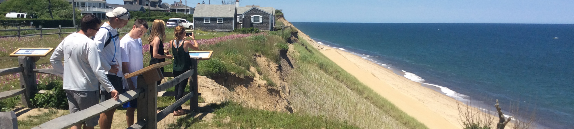
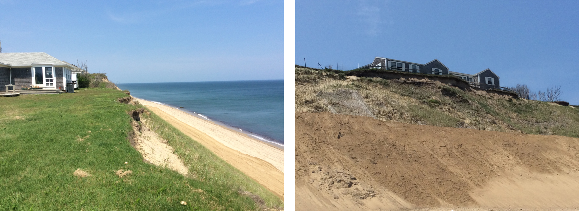
Average number of feet each year that the ‘Sconset Bluff has eroded for the past 20 to 30 years. In recent difficult storm years, up to 30 feet have been lost from the bluff in isolated locations.
29
The closest point between the top of ‘Sconset Bluff and Baxter Road (a public way).
20
Houses on the bluff that were moved or demolished, leaving vacant lots (eight) or moved back to the roadway (12).
$500,000
The amount of additional taxes that is being paid by all island taxpayers each year, due to the millions of dollars in lost home value on Baxter Road because of erosion in 2014.
There is both an opportunity and a challenge before us: preserving ‘Sconset Beach and Bluff in a way that limits future erosion, stabilizes the current bluff and does not inadvertently accelerate erosion elsewhere on the island. Doing so may not be the right choice for every community on Nantucket facing erosion challenges, but we are hopeful that protecting ‘Sconset Beach and Bluff can serve as a model for other communities who may choose similar measures in the future.